
|
|
|
|
| |||||||||||||||||||||||
|
Combat Scenes In France |
||||
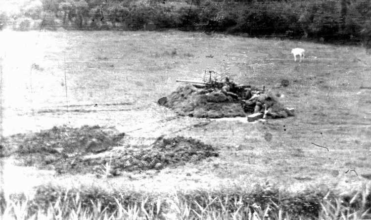 Cannon emplacement with bare-chested man leaning against sandbags on right. Another man may be standing directly behind cannon. A near-miss crater seems to be at left while a cow placidly grazes on the right. |
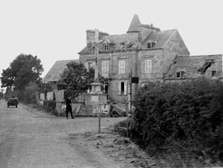
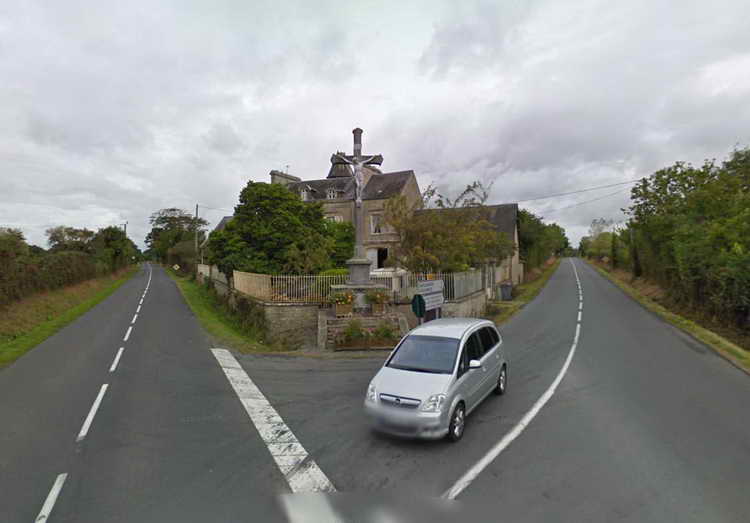
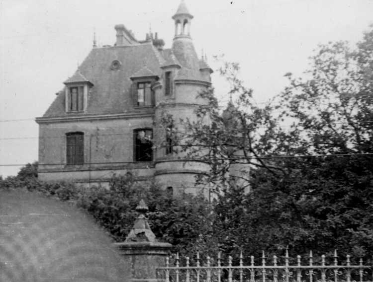 Château au Hameau de Le Mont, commune de Rauville-la-Place (Manche), (view the mansion today) [ID and link courtesy of Claude Demeester] |
 (Picauville area that has been nearly obliterated by bombing - location identified by citizen Pierre PHILIPPINE) |
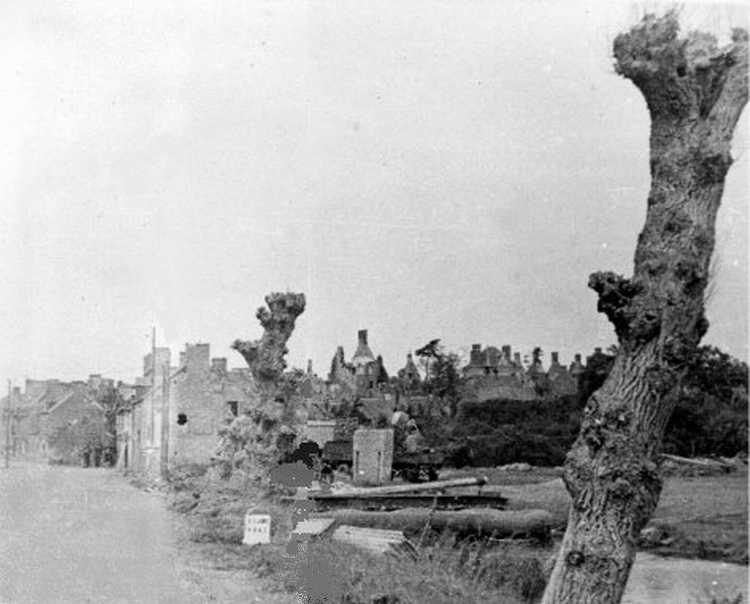
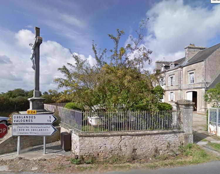
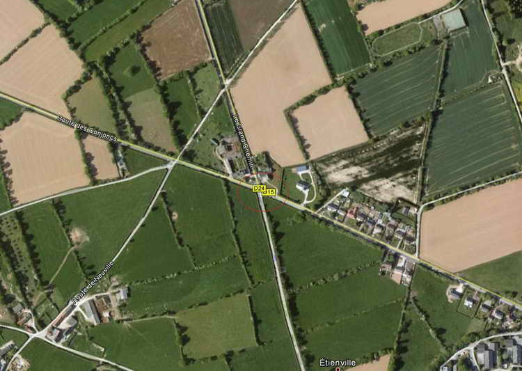
(Unknown location, sign reads "GC 15 ahead, GC-24 to right".) |
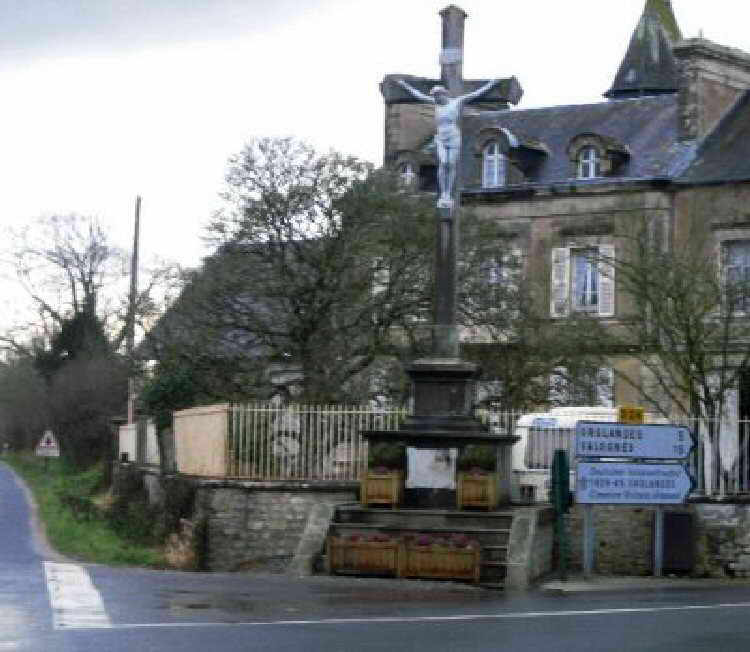 Color photo taken January 2009. of a crossroads on the outskirts of Picauville on the road to St Sauveur-le-Vicomte Unidentified researcher stated, " So, very little has changed at the crossroads which I believe are at Pont l'Abbe [Abbotts Bridge], the building is virtually identical, the roof window on the top right of the original photo has been removed. two signs have been added at the lower right of the comparison photo, the top one is for the town of Valognes which is midway between Cherbourg and St Mere Eglise. The lower sign is for the German cemetery at Orglandes 5 kilometers away, this cemetery has been there since the invasion. The barn to the left of the Chateau-farm is still there as are all the metal fencing around the front. The large bush in the front garden behind the cross is probably twice as large than it was during the war, this is a flowering bush and I have seen it during the summer in full bloom. The large tree seen on the left of the original photograph is still there, however it's now winter and the original photo was shot during the summer. The cross is dated 1928. |
 |
 |
 |
Read further update on this location from Jim Wrobleski, below: | |
|
"Al Gerheim sent me some information regarding the Google Map location of "Moaning Meadows" near Sissonne, France. I couldn't help but notice the called "Unknown location, sign reads "GC 15 ahead, GC-24 to right." The roads are now called D15 and D24 [which] is the road that comes up from the south in the center of Pont L'Abbe, turns west for a mile or so before turning north again to head to Orglandes. D15 is basically the road from Utah beach to the west that the 508th (basically) followed in cutting off the peninsula. Coincidentally, Orglandes is the village that Al's dad, Harry Gerheim, had marked as his DZ on his jump map. I had walked through the field there where he had marked. I also had a conversation with Monsieur Lucien Hasley (with interpretation by Rodolphe Roger of La Fiere B&B) about this. When we showed Lucien a printout of Harry's jump map showing the place marked DZ, Lucien was quick to remark that there was only one group that landed so far north. He told us that the property owners rounded up that stick of Troopers and hid them in the sheep barn. They had to hide them as the Germans were using their Manoir as a headquarters. That was the local anti-aircraft battery HQ! They were out shooting at the C-47's that evening, giving the residents time to hide these men. I couldn't believe my luck! The story about the war that Harry [told] my mother, that he had been given a hiding place in the rafters of a barn near where he landed. He said he was there three days, hiding. He could look down and see the Germans walking around their equipment. They had to be very still for three days. After three days Harry said that the Germans left and they were free to go. He said that the French pointed the way back to the American lines and tried to escort them, in relays, back to the unit. When we told that story to Monsieur Hasley we were all surprised because Lucien said that his parents helped bring those men back to their unit! Can you imagine how excited we were? Anyway, I attached a Google Map of the intersection that I mentioned. Note the sign on the close-up that shows the way to the German cemetery is in Orglandes. Which makes sense since it was the area HQ!" Jim Wrobleski, 2/7/2012 |
||||
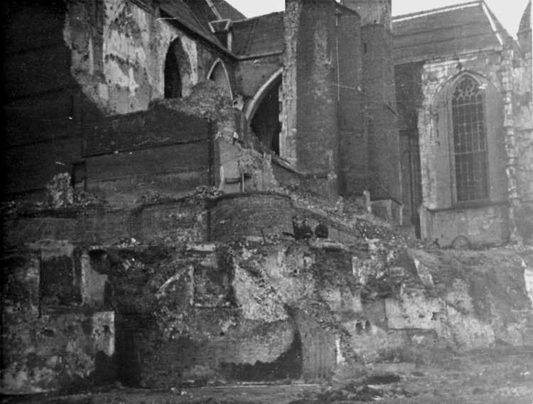 (Chateau de Saint Sauveur Le Vicomte bomb damage - location identified by citizen Pierre PHILIPPINE) |
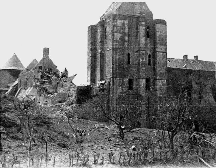 (Another view of Chateau) |
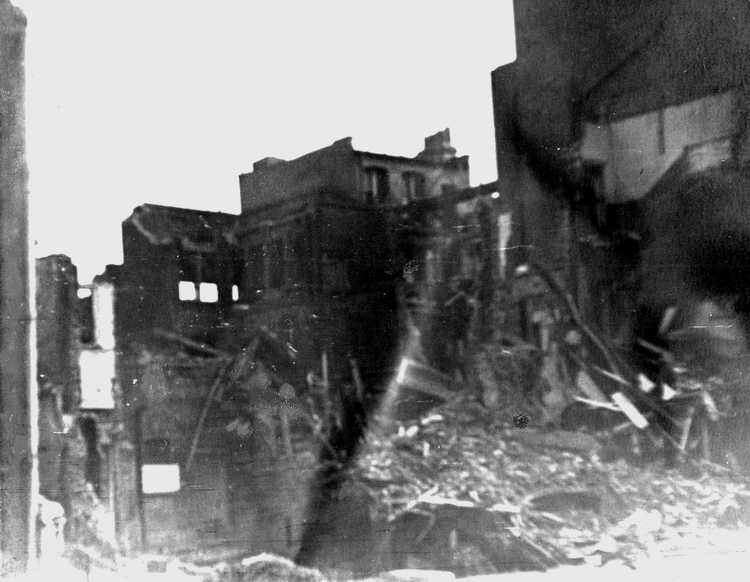 (More bomb damage) |
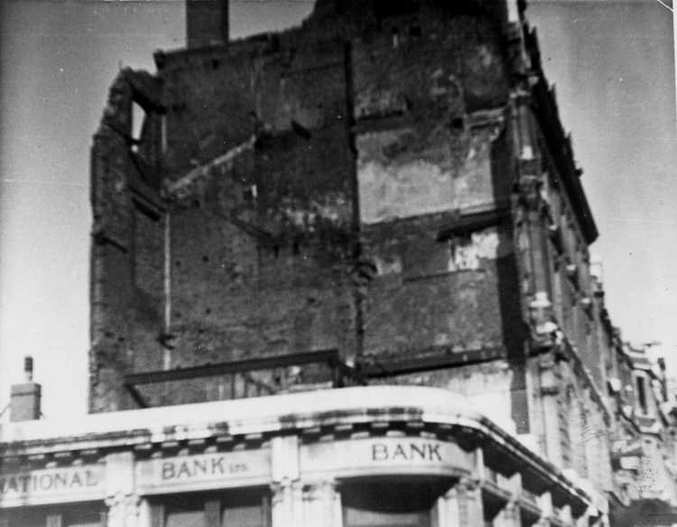 (National Bank with damage) |
|