Next stop - Normandy Next stop - Normandy
this signpost seems to say.
There were no such signs here 60 years ago but the goals to move east and inland were clear to the landing troops.
The line of march would take them through Normandy and into Belgium before the final push into Berlin.
The effort would last for eighteen months and cost untold thousands of human lives.
| 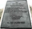
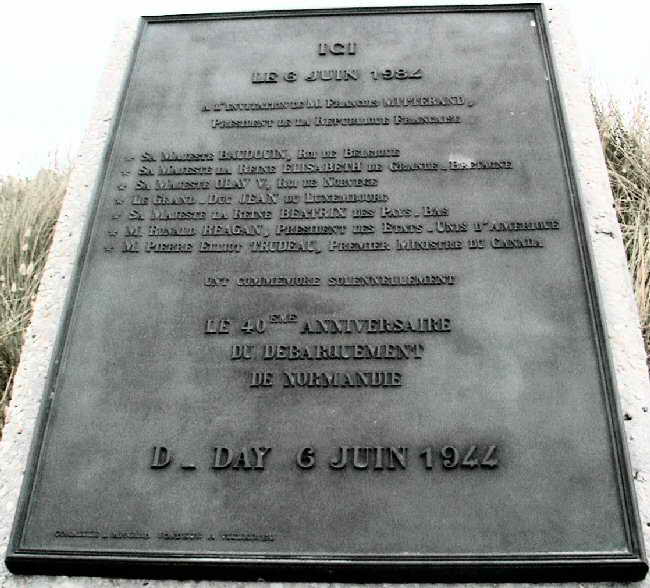
President Mitterand
and others placed this bronze tablet here on June 6, 1984 Inscription reads:
"IN SOLEMN COMMEMORATION OF THE 40TH ANNIVERSARY OF THE DEBARKMENT AT NORMANDY"
|  A Milestone Event Now Marked A Milestone Event Now Marked
The first of 1,146 Bornes, or milestones, marking every kilometer along the route taken by the U.S. Armies, a route later to be called "Liberty Road".
"Liberty Road" was the main route of advance of the U.S.. Armies in their rout of the German Army, and thereafter it also became the main supply route from Cherbourg and Omaha Beach to Bastogne in Belgium.
Today, four of these unique markers are on display in the United States, Borne, #35, from the highway #174 between Utah Beach and St. LO is at the Camp Blanding museum.
Each Borne is 48" high, 24" in diameter at the base, tapering upwards to 18" diameter near the top, with a rounded top, and weighing 716 pounds.. (Photo courtesy Karine Guilbert)
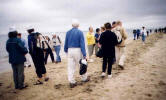
Vets Walk The Sands
of Utah once more while undoubtedly remembering those who could not return |

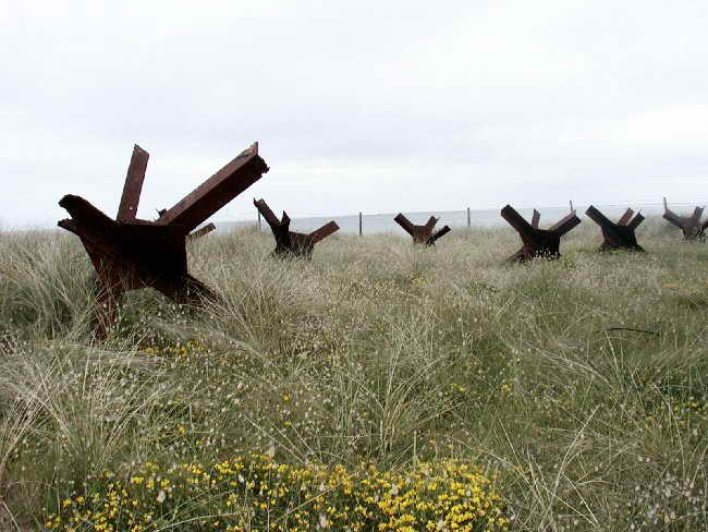
By The Hundreds
these hedgehogs made of steel beams were intended to thwart landing ships. Once they lined the shores of Normandy in multiple rows. Today these few examples remain
|

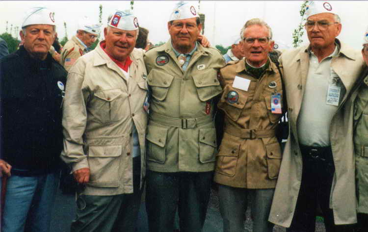
Hq 2nd Mini Reunion
[l-r] Bill Biagioni, Chet Graham, Bob Speers, Zane Schlemmer and
George Fairman were all from Hq Co, 2d Battalion. Biagioni was
in the commo platoon and the other three EM were 81mm mortar
men. Chet was their commander. Sliced out of the photo on the
right is Irv Shanley who was also in the mortar platoon.(courtesy
of Irv Shanley)
|