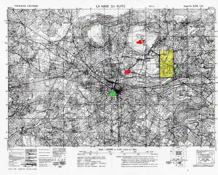
Area of la Haye du Puits with key areas overlaid
with color.
Red -
Hills 95 and 131
Green - La
Haye du Puits, la Poterie and Lithair
Yellow -
area in which action of 4 July 1944 took place including Capt.
Axelrod's heroics
Map courtesy of the Rex Combs collection.
Colored highlights added by Jumpmaster
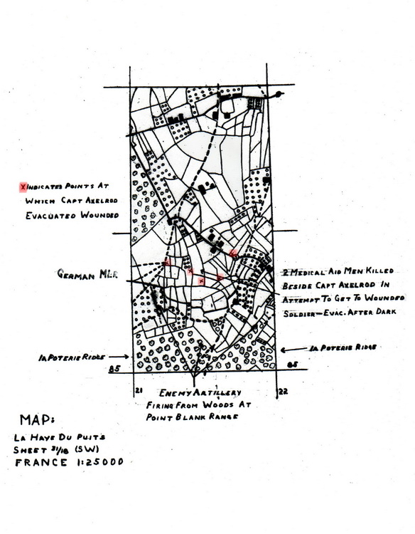
Hand-drawn map prepared by Rex Combs.
The diagram is to scale and matches the yellow
highlighted area on the above map. Note five X-marks
(highlighted in red) indicating where wounded lay that day.
Four of the sites are immediately in front of the German MLR (Main
Line of Resistance).
It does not specify which position was where Lt.
Jones was hit.
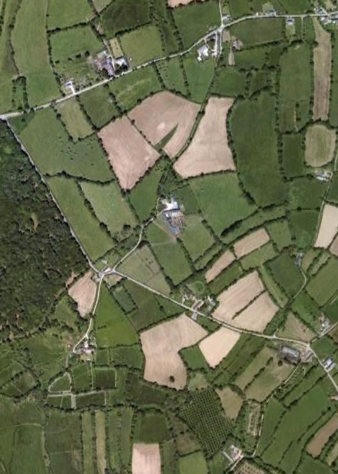
Same Area As It Appears Today
Satellite photograph cropped from a Google Earth
image shows that the field and road patters have not changed to any
great degree. Even the buildings shown closely r3esemble the
groups indicated on the map although some may have been damaged, or
destroyed, during the war.
Copyright and all other rights reserved by the
Family and Friends of The 508th Parachute Infantry Regiment Association or by
those who are otherwise cited,
For problems or questions regarding this web site, please contact
Jumpmaster.