GRAPHIC AND PHOTOGRAPHIC VIEWS OF
D-DAY ACTION (2 of 3)
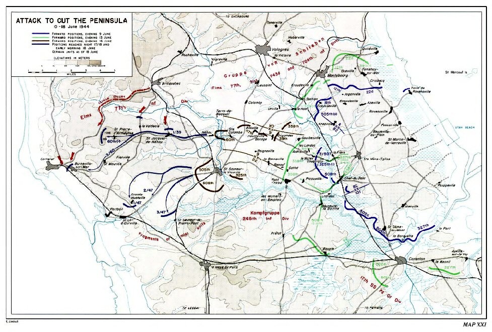
Attack
To Cut The Peninsula map shows intended drop zones and assignments
for 10 Army units
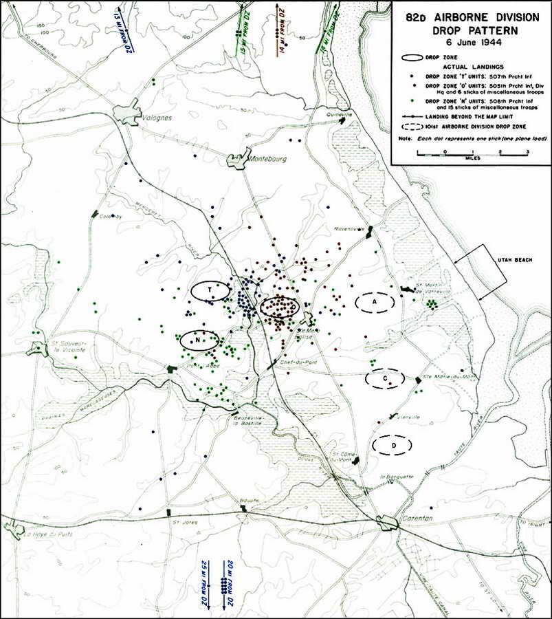
82nd Airborne Drop Pattern documents how widely the troopers were scattered.
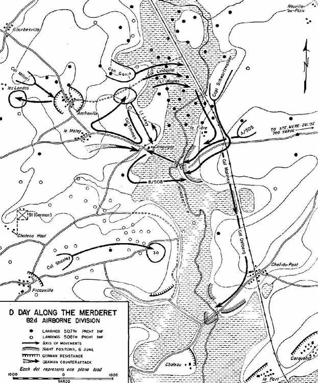
D-Day Along The Merderet
details Col. Lindquist's group advancing east above La Fière while Col
Shanley closes in on the infamous Hill 30
(courtesy Tony Rogers)
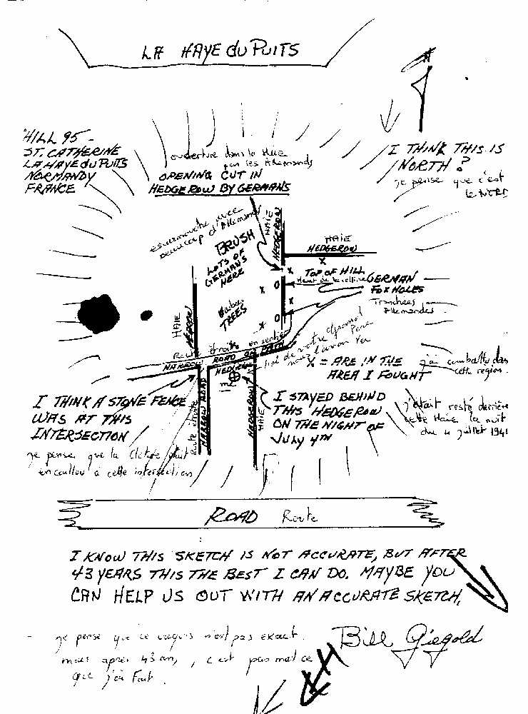
La
Haye Du Puits as Bill Giegold remembered it 43 years later.
His hand drawn map is annotated in his own words and also translated into
French
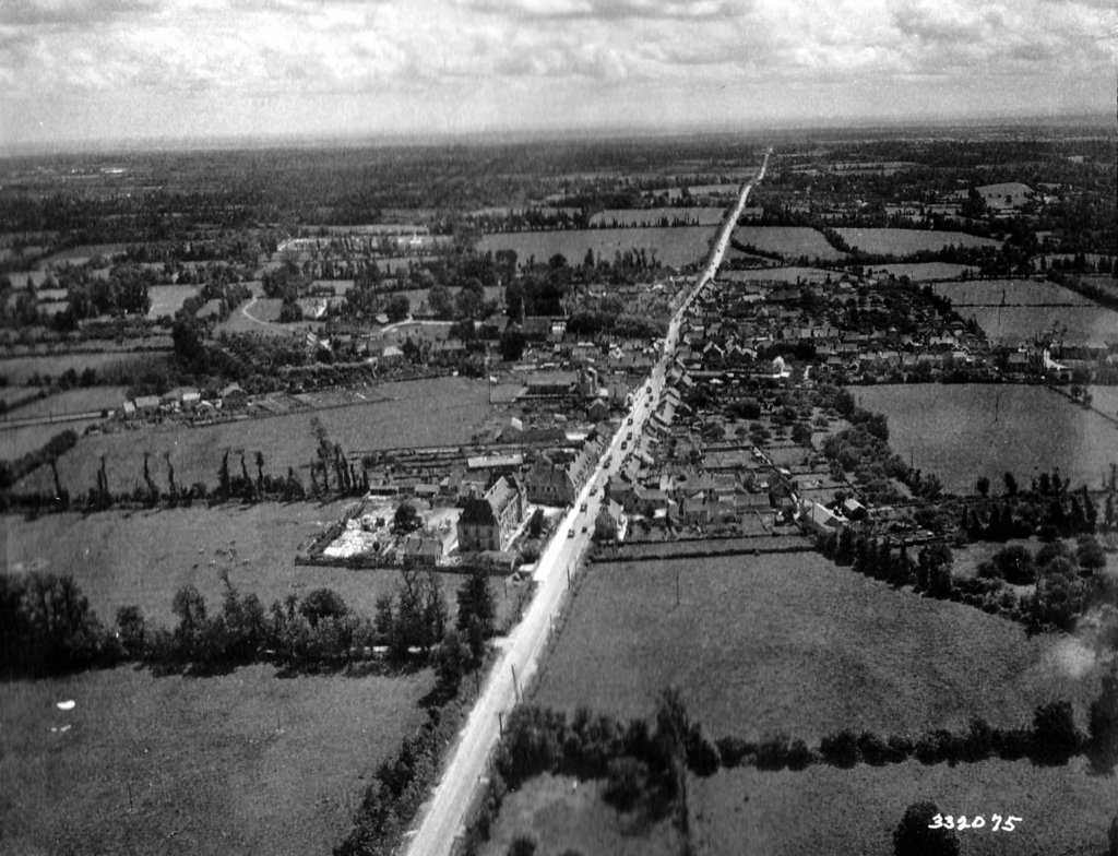
Ste Mere Eglise as it appeared in 1944. Note the military vehicles on the
main road.
(courtesy of Ken Lewis)
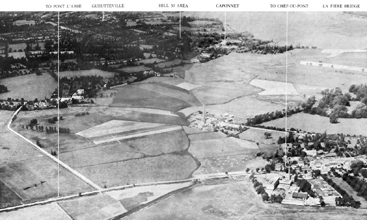
Chef Du Pont shows the area from "Pont Le'Abbe at left to La Fière Bridge on right. What appears to be chutes are more
likely animals grazing or perhaps haystacks.
(courtesy David Berry)
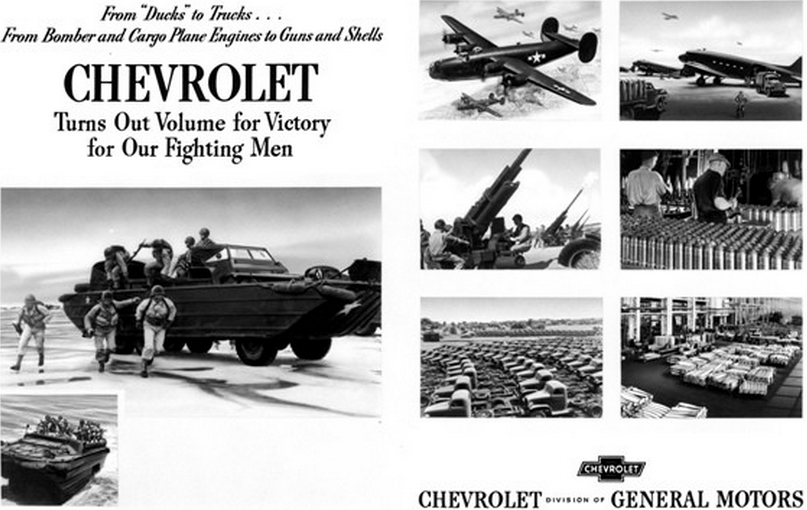
Not Your Father's Chevy while later singing advertisements had the line of "See the USA in your
Chevrolet" these vehicles toured the European and Pacific theaters of war
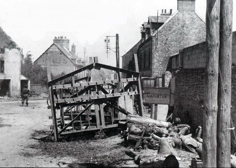
Chef du Pont street scene with GIs resting in lower right while another
stands guard in the roadway
[this and next two photos courtesy of Kenneth
Lewis]
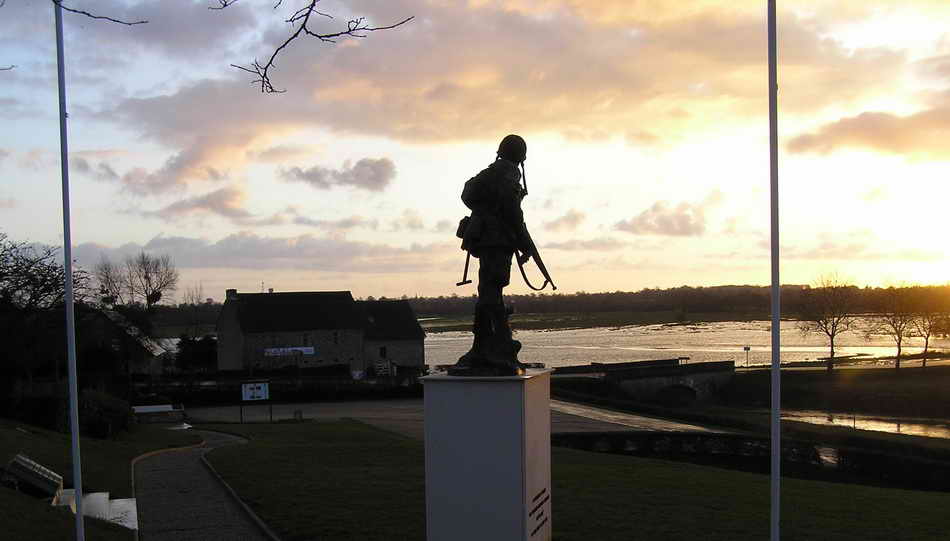
Then and Now Iron Mike statue at La Fière looks out on a flooded Merderet
plain. The scene must have been much like this on D-Day.
(courtesy Vivian Roger)
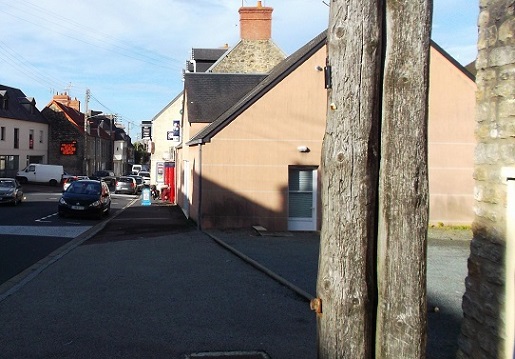
Revisiting I love what you have done with the
place! The building in the foreground has replaced the ruins but the
other building remains
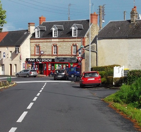
Alternate
View from road intersecting directly opposite the original structure now the
Bar du Stade advertising tobacco and lotto tickets, amongst other items.
Copyright and all other rights reserved by the
Family and Friends of The 508th Parachute Infantry Regiment Association or by
those who are otherwise cited,
For problems or questions regarding this web site, please contact
Jumpmaster.